


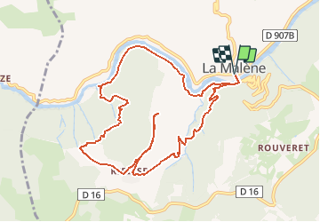
La Malène - Roc de Serre - Roc des Hourtous

frizou83
User

Length
11.7 km

Max alt
922 m

Uphill gradient
538 m
Km-Effort
18.8 km

Min alt
442 m

Downhill gradient
538 m
Boucle
Yes
Creation date :
2019-07-28 18:19:42.117
Updated on :
2019-07-28 18:20:48.061
3h52
Difficulty : Difficult

FREE GPS app for hiking
 SityTrail
IGN / Geographical institutes
SityTrail Plus
The world is yours!
About
Trail Walking of 11.7 km to be discovered at Occitania, Lozère, La Malène. This trail is proposed by frizou83.
Positioning
Country:
France
Region :
Occitania
Department/Province :
Lozère
Municipality :
La Malène
Location:
Unknown
Start:(Dec)
Start:(UTM)
525546 ; 4905388 (31T) N.
Comments